AAU Herbarium Database |
| New Search Modify Search |
| Collector | Balslev, H. |
| Number | 62502 |
| Collected with | Galeano, G. & Bernal, R. & Bergmann, B. |
| Country | Ecuador |
| Subpart | NAPO |
| County | |
| Locality | Rio Napo, 30 - 40 km downstream from Misahualli at Campana Cocha. Tropical rain forest on terra firme. |
| Coordinates | 0° 55' S 77° 25' W |
| Minimum elevation (m) | 450 |
| Maximum elevation (m) | 450 |
| Start date | 1987/05/07 |
| End date | 1987/05/07 |
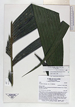
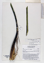
| Family | Arecaceae |
| Identification | Geonoma interrupta subsp. interrupta Mart. |
| Determined by | A. Henderson |
| Identification qualifier | |
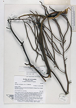
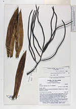
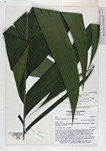
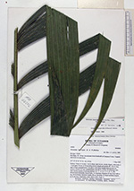
| Field notes | Solitary. Stem to 4 m tall, 3 cm in diam, light brown, clearly ringed, with nodes 2 - 4 cm apart. Crown of 10 spreading leaves; sheath and petiole 40 - 50 cm long, open to base, rounded below, flat above with sharp margins between the two surfaces. Rachis 142 cm, rounded below, flat above, at base, 10 pinnae per side with varying number of primary nerves ( 10 - 7 - 4 - 8 - 2 - 7 - 6 - 1 - 24). Inflorescence infrafoliar, brownviolet, 3 x branched. Peduncle 34 cm, 2 cm wide at top, dorsiventrally flattened. Rachis 48 cm. Rachillae 20, basal rachillae longest, to 52 cm long. Duplicates: AAU, QCA, COL. Dupl. 3. |
| |
 Other records of Geonoma interrupta subsp. interrupta Other records of Geonoma interrupta subsp. interruptaThe map displays only records from the Aarhus Herbarium Database. The records may not represent the full distribution of Geonoma interrupta subsp. interrupta |
| New Search Modify Search |