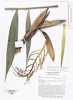
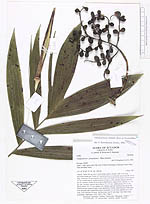
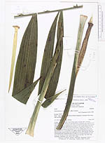
| Field notes | Solitary. Stem 150 cm tall, 3 cm in diam, green, smooth with 5 cm long internodes at the top. Crown of 3 spreading leaves; leafsheath green smooth, 40 cm long, closed for 30 cm, bending away from crownshaft for the upper 10 cm; petiole 10 cm, rounded below, shallowly grooved above, with rounded margins between the two surfaces; rachis 90 cm long rounded below, angled above; pinnae 13 - 14 per side, regularly spaced; basal pinnae 23 x 2.5 cm, middle pinnae 35 x 6 cm, apical pinnae 19 x 5.5 cm, pinnae very slightly sigmoid. Inflorescence buds and infructescences inserted singly at the uppermost 4 nodes. Infructescence with scars from prophyll and 4 peduncular bracts, peduncle 14 cm long; rachillae six, 6 cm long, each with up to 8 fruits. Inflorescence bud 19 cm long, 2 cm wide, long acuminate. Duplicates: AAU, QCA, COL. Dupl 3. |