AAU Herbarium Database |
| New Search Modify Search |
| Collector | Balslev, H. |
| Number | 62474 |
| Collected with | Bergmann, B. & Pedersen, H. B. |
| Country | Ecuador |
| Subpart | NAPO |
| County | |
| Locality | Misuahalli 2 - 3 km north east of the village (east of Rio Misuahalli. Patches of primary and secondary forest (tropical rain forest). |
| Coordinates | 1° 3' S 77° 34' W |
| Minimum elevation (m) | 450 |
| Maximum elevation (m) | 450 |
| Start date | 1987/04/03 |
| End date | 1987/04/03 |
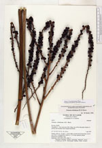
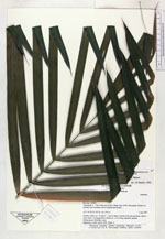
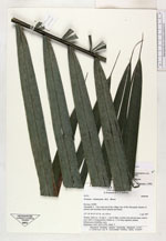
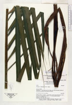
| Family | Arecaceae |
| Identification | Prestoea schultzeana (Burret)H.E. Moore |
| Determined by | H. Balslev |
| Identification qualifier | |
| Field notes | Solitary. Stem ca. 1 m tall, 6 - 7 cm in diam, covered with old leaf bases. Leaves erect with 1 m long petioles; blades ca. 1.5 m long, regularly pinnate. Inflorescence infrafoliar, erect. Duplicates: AAU, QCA, COL. Dupl. 3. |
| |
| Display all 78 georeferenced records of Prestoea Prestoea schultzeana |
| New Search Modify Search |