AAU Herbarium Database |
| New Search Modify Search |
| Collector | Balslev, H. |
| Number | 62430 |
| Collected with | Bergmann, B. & Pedersen, H. B. |
| Country | Ecuador |
| Subpart | PASTAZA |
| County | |
| Locality | Puyo - Macas road km 8 and 2 km to the east. Tropical rain forest on Andean foothills. |
| Coordinates | 1° 30' S 77° 57' W |
| Minimum elevation (m) | 1080 |
| Maximum elevation (m) | 1080 |
| Start date | 1987/03/22 |
| End date | 1987/03/22 |
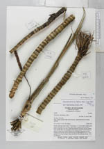
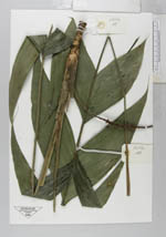
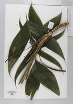
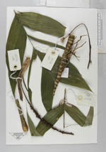
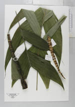
| Family | Arecaceae |
| Identification | Geonoma stricta subsp. arundinacea (Mart.) A.J.Hend. |
| Determined by | A. Henderson |
| Identification qualifier | |
| Field notes | Solitary understory palm. Stem 5 - 80 cm long, 1.5 - 2 cm in diam, conspicuously ringed, internodes ca. 0.5 cm long, yellow brown, smooth. Crown of 8 erect leaves; sheath open to the base, sheath and peduncle 70 cm long, the base rounded below and flat above, the top round in cross section, blade 50 x 30 cm with 2 x 3 pinnae of unequal size, sigmoid. Inflorescence interfoliar, unbranched erect and bending away from the leaves, blood red colour, prophyll ligth brown 13 x 1 cm, penducle 13 cm long, rounded; rachis with flowers, not producing rachillae, 16 X 1 cm, blood red. |
| |
| Display all 43 georeferenced records of Geonoma Geonoma stricta subsp. arundinacea |
| New Search Modify Search |