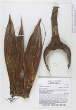
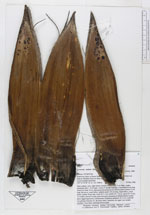
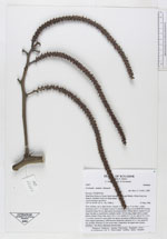
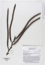
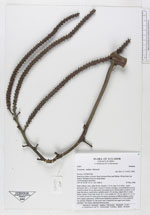
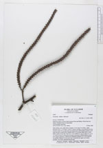
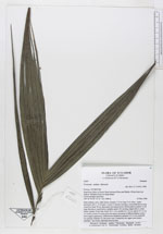
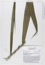
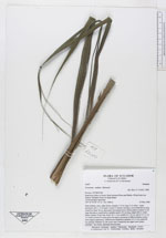
| Field notes | Stem solitary, erect, light brown, smooth, 4.75 m long, 9 cm diam., nodes prominent and 4 - 6 cm apart. Leaves 9; sheaths forming a crownshaft 60 cm long closed for basal 10 cm, light green becoming brown, fibrous above; petiole 23 cm long, flat above, round below, reddish; rachis 149 cm long, ridged above, round below; pinnae 39 per side, lower 39 x 1 cm, middle 62 x 10 cm, apical 25 x 6 cm, 1 4 veined, inserted in same plane but apices drooping in different planes to give leaf a ragged appearance. Inflorescence infrafoliar; peduncle 19 x 4 cm; rachis 60 cm; primary branches 22, the lower ones 3 branched, the upper ones simple; rachillae 7 mm thick; staminate flowers pink. |