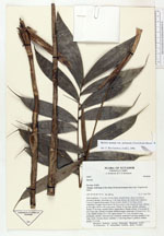
| Field notes | Stem cespitose, 1.5 m tall, 0.6 cm thick, smooth below, above covered in persistent sheaths; internodes ca. 4 cm long, brown, the whole plant spineless. Leaves 8, spaced along upper 30 cm of stem, sheath 13 cm long, closed completely in upper leaves and in the lower leaves only towards the base, fibrous at the edges, brown with some green. Petiole 34 cm long, smooth, subterete. Rachis 35 cm long, rounded below, ridged above. Pinnae solitary or in groups of two, 8 per side, inserted at slightly different angles; basal pair of pinnae erect, 18 x 2 cm, middle pinnae 20 x 3 cm, apical pinnae 17 x 2 cm, all pinnae long acuminate, smooth. Infructescence interfoliar; peduncle 9 cm long, prophyll 5 cm long, rachis virtually absent, rachillae 3, 2 cm long, fruits 5, globose, reddish purple, 2 x 2 cm. |
 Other records of Bactris maraja var. juruensis