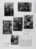
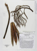
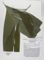
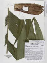
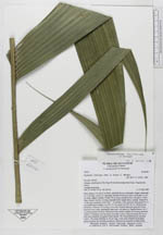
| Field notes | Stem solitary, 3 m tall, 3 cm diam., greenish brown, moderately ringed, internodes ca. 2 cm long. Leaves 14, spreading. Sheaths forming an open crownshaft, ca. 40 cm long, slightly swollen. Petiole 50 cm long, rounded below, flat above, with a sharp margin. Rachis 1 m long, rounded below ridged above, smooth. Pinnae 9 to 11 per side, unequally wide with 2 - 12 primary veins, sigmoid, basal pinna 34 x 4 cm, middle ones variable, e.g. 65 x 15 cm, apical one 50 x 16 cm. Inflorescence infrafoliar. Peduncle 35 cm long, 2 cm wide, slightly flattened, greenish brown, prophyll scar at base, peduncular bract scar 4 cm above it. Prophyll brown, 20 x 7 cm longitudinally fissured. Peduncular bract similar. Rachis 30 cm long, greenish yellow. 14 branches leaving rachis, the basal 3 ones 3 times branched, the next 5 ones once branched, the apical 6 ones simple. The whole inflorescence greenish yellow. The actual rachillae ca. 20 cm long, 3 mm wide. Peduncle horizontal, rachis, branches and rachillae pendulous. Inflorescence branches twisted in bud. |
 Other records of Geonoma interrupta var. interrupta