| Collector | Balslev, H. |
| Number | 62030 |
| Collected with | Henderson, A. & Borchsenius, F. |
| Country | Ecuador |
| Subpart | COTOPAXI |
| County | |
| Locality | 20 km east of La Maná on road to Latacunga from Quevedovia Pilaló. Montane forest on steep slope. |
| Coordinates | 0° 53' S 79° 4' W |
| Minimum elevation (m) | 1100 |
| Maximum elevation (m) | 1100 |
| Start date | 1986/04/06 |
| End date | 1986/04/06 |
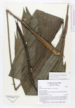
| Family | Arecaceae |
| Identification | Geonoma cuneata var. cuneata H.Wendl. ex Spruce |
| Determined by | H. Balslev |
| Identification qualifier | |
| Field notes | Stem solitary, procumbent, 70 cm long, 5 cm diam, brown internodes prominent and very close together. Leaves 5 erect to arching more or less entire; petiole including sheath 80 cm long; rounded below flat above; rachis 67 cm long blade 36 cm at middle. Inflorescences erect; peduncle 60 cm long; rachis 27 cm long. Immature fruits green. |
|