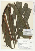
| Collector | Balslev, H. |
| Number | 62025 |
| Collected with | Henderson, A. & Borchsenius, F. |
| Country | Ecuador |
| Subpart | PICHINCHA |
| County | |
| Locality | Hda. Irena 36 km south of Santo Domingo along road to Quevedo. Remnants of moist forest. |
| Coordinates | 0° 22' S 79° 20' W |
| Minimum elevation (m) | 300 |
| Maximum elevation (m) | 300 |
| Start date | 1986/04/02 |
| End date | 1986/04/04 |
| Family | Arecaceae |
| Identification | Geonoma irena Borchs. |
| Determined by | Borchsenius, F. (AAU), 1996. |
| Identification qualifier | |
| Field notes | Solitary, stem c. 30 x 5 cm Lvs. c. 7 spreading. Inflorescence infrafoliar. Note two inflorescences emerging in one prophyll and peduncular bract. |
|
 Other records of Geonoma irena