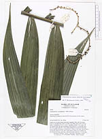
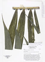
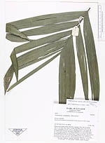
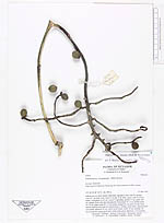
| Field notes | Solitary tree on steep roadcut with dense vegetation. Base with 50 cm high cone of 1 cm thick roots. Stem 5.5 m tall, 6 cm thick, green, with 15-20 cm nodes. Crownshaft ca. 65 cm. Leaves 5, spreading, petiole 77 cm, rachis 160 cm, pinnae 26 per side plus topsegments, basal pinna 43 x 2 cm middle pinna 62 x 8 cm, upper pinna 29 x 2 cm, pinnae arranged in one plane but the basal pinnae standing somewhat up. Infrutescence 3, solitary at the nodes, inserted below crownshaft, peduncle 32 cm, with 4 sterile bracts, rachis 16 cm, rachillae 18, 16-12 fruits are young, green later, oldest fruits green spherical, 1.5-2 cm diam. |