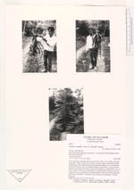
AAU Herbarium Database |
| New Search Modify Search |
| Collector | Balslev, H. |
| Number | 60676 |
| Collected with | Henderson, A. & Skov, F. |
| Country | Ecuador |
| Subpart | PICHINCHA |
| County | |
| Locality | Road from Santo Domingo to Quevedo, 12 km south of Santo Domingo. Road side, weedy vegetation. |
| Coordinates | 0° 17' S 79° 15' W |
| Minimum elevation (m) | 300 |
| Maximum elevation (m) | 300 |
| Start date | 1985/07/24 |
| End date | 1985/07/24 |
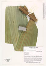
| Family | Arecaceae |
| Identification | Wettinia aequalis (Cook & Doyle)R. Bernal |
| Determined by | Bernal, R. (COL), 1993. |
| Identification qualifier | |
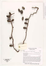
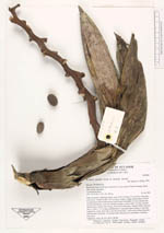
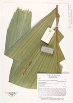
| Field notes | Roots numerous, forming a dense cone 30-40 cm long, 2-3 cm thick, with spiny projections. Trunk 6 m tall, 10.5 cm diam, solitary, rough at internodes, formed by depressions when inflorescence buds formed, internodes 2-5 cm, covered with mosses and lichens. Leaves 8; sheaths forming a crown shaft 1 m long, smooth, blackish grey; petiole 40 cm long, with brown tomentum, rounded below, grooved above; rachis c. 2.5 m long, rounded below, triangular above; pinnae 31 per side, reduplicate, entire, borne all in one horizontal plane, with nerves yellow adaxially. Inflorescence infrafoliar, 14 buds per node; infructescence pendulous, immature fruit green. Duplicates: AAU, K, NY, QCA, QCNE. |
| |
 Other records of Wettinia aequalis Other records of Wettinia aequalisThe map displays only records from the Aarhus Herbarium Database. The records may not represent the full distribution of Wettinia aequalis |
| New Search Modify Search |