AAU Herbarium Database |
| New Search Modify Search |
| Collector | Balslev, H. |
| Number | 4290 |
| Collected with | A. Arguello and B. Aguirre |
| Country | Ecuador |
| Subpart | NAPO |
| County | |
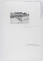
| Locality | 4 km NE of Borja and 1 km to the west along take-off towards Sardinas near Quito - Lago Agrio road. Remnants of montane forest on escarpment towards river. |
| Coordinates | 0° 22' S 77° 49' W |
| Minimum elevation (m) | 1600 |
| Maximum elevation (m) | 1600 |
| Start date | 1983/04/03 |
| End date | 1983/04/03 |
| Family | Arecaceae |
| Identification | Chamaedorea pinnatifrons (Jacq.)Oerst. |
| Determined by | |
| Identification qualifier | |
| Field notes | "(Chamaedorea sp.). A 3 m high solitary tree-let. Trunk green, 2 cm diam, with 15 cm long internodes. Old leafbases persisting below crown. Crown of 5 leaves. Inflorescences 2, originating among old, wilted? leafbases below crown; rachis, branches and fruit orange. Uses: No uses or local names noted." |
| |
| Display all 228 georeferenced records of Chamaedorea Chamaedorea pinnatifrons |
| New Search Modify Search |