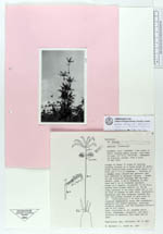
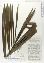
| Field notes | (Euterpe sp.). Clumps of ca 10 trees of varying heights growing on a large mound of interwoven advertition roots; mound ca 2 m high and 1.5 m in diam. Growing in an swampy area cleared for pasture and not observed in adjacent forest. Trunk of collected tree 8.80 m high, smooth, grey, 8 cm diam basally, 6 cm diam apically. Crown of 8 leaves; crownshaft 80 cm. Leaves with closed sheaths ca 80 cm long, petiole 10 cm; blade 200 x 100 cm with 39 pinnae on each side, rachis ascending and dropping towards the tip; pinnae pendant on each side. Inflorescences 2 on this trunk; inserted immediately below crownshaft; rachis straight pointing slightly upwards and the branches sticking out to all sides. According to Sr. Armando Ortiz Silva this plant has no uses. |
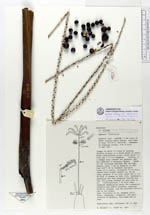
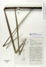
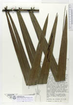
 Other records of Euterpe catinga var. roraimae