AAU Herbarium Database |
| New Search Modify Search |
| Collector | Balslev, H. |
| Number | 11430 |
| Collected with | Manop Poopath, Natcha Sutjaritjai, Wirata Rujichaipimon, Chanisttha Seesawang, Preecha Karaket, Sukontip Sirimongkol, John Jameson, Prasit Sudprasert, Kantima Suwannawat, Laksika Rodpothong, Sukid Rueangruea, Theerawat Thananthaisong |
| Country | Thailand |
| Subpart | Trat |
| County | |
| Locality | Koh Chang. Forest trail crossing the island from Tan Mayon to Klung Phlu waterfall. Evergreen forest away from Tan Mayon river on hills |
| Coordinates | 12° 4' 6'' N 102° 19' 52'' E |
| Minimum elevation (m) | 410 |
| Maximum elevation (m) | 410 |
| Start date | 2024/01/22 |
| End date | 2024/01/22 |
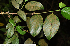
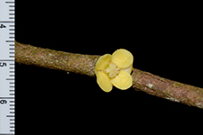
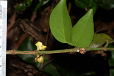
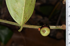
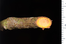
| Family | Clusiaceae |
| Identification | Garcinia hanburyi Hook.f. |
| Determined by | |
| Identification qualifier | |
| Field notes | Tree 7 m tall |

| |
 Other records of Garcinia hanburyi Other records of Garcinia hanburyiThe map displays only records from the Aarhus Herbarium Database. The records may not represent the full distribution of Garcinia hanburyi |
| New Search Modify Search |