AAU Herbarium Database |
| New Search Modify Search |
| Collector | Balslev, H. |
| Number | 11325 |
| Collected with | Manop Poopath, Natcha Sutjaritjai, Pornchai Kladwong, Wirata Rujichaipimon, Birgitte Bergmann, Chanittha Seesawang,Tanawat Teeranan, Nophadol Phoemphoen, Kantima Suwannawat, Anupong Tinnavan, Nathawan Suphuntee & Sumalee Somngam. |
| Country | Thailand |
| Subpart | Trat |
| County | |
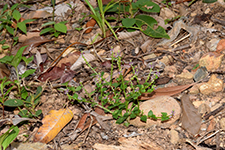
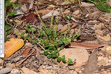
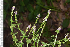
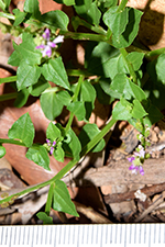
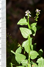
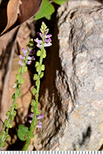
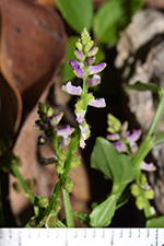
| Locality | Koh Chang. Nothern perifery road at old navy station. Ban Dan Kao. Wet evergreen forest, 30-40 m high. Plants pressed in field and preserved in alcohol before drying |
| Coordinates | 12° 8' 32'' N 102° 17' 52'' E |
| Minimum elevation (m) | 18 |
| Maximum elevation (m) | 18 |
| Start date | 2023/08/07 |
| End date | 2023/08/07 |
| Family | Polygalaceae |
| Identification | Polygala |
| Determined by | |
| Identification qualifier | |
| Field notes | Roadside weed |
| |
| Display all 28 georeferenced records of Polygala Polygala |
| New Search Modify Search |