AAU Herbarium Database |
| New Search Modify Search |
| Collector | Balslev, H. |
| Number | 11315 |
| Collected with | Manop Poopath, Natcha Sutjaritjai, Pornchai Kladwong, Wirata Rujichaipimon, Birgitte Bergmann, Chanittha Seesawang,Tanawat Teeranan, Nophadol Phoemphoen, Kantima Suwannawat, Anupong Tinnavan, Nathawan Suphuntee & Sumalee Somngam. |
| Country | Thailand |
| Subpart | Trat |
| County | |
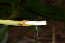
| Locality | Koh Chang. Near Baan Jekbae along road to Koh Chang Memorial, 1.7 km from take off. Secondary forest in dry evergreen forest, deep red lateriltic soil. Plants pressed in the field and preserved in alcohol before drying |
| Coordinates | 11° 58' 50'' N 102° 24' 21'' E |
| Minimum elevation (m) | 38 |
| Maximum elevation (m) | 38 |
| Start date | 2023/08/07 |
| End date | 2023/08/07 |
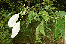
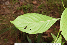
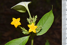
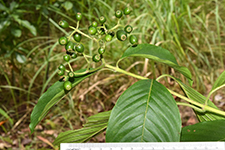
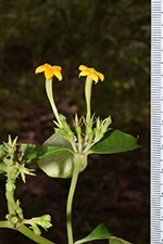
| Family | Rubiaceae |
| Identification | Mussaenda |
| Determined by | |
| Identification qualifier | |
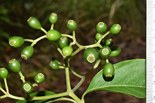
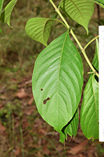
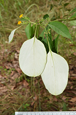
| Field notes | Climber 10 m long. Flowers bright orange |
| |
 Other records of Mussaenda Other records of MussaendaThe map displays only records from the Aarhus Herbarium Database. The records may not represent the full distribution of Mussaenda |
| New Search Modify Search |