AAU Herbarium Database |
| New Search Modify Search |
| Collector | Pedersen, H. B. |
| Number | 97621 |
| Collected with | Evans, D. |
| Country | Ecuador |
| Subpart | PASTAZA |
| County | |
| Locality | North of Rio Pastaza, near the Achuar village of Mashient southwest of Copataza. Along trail through primary forest. |
| Coordinates | 2° 8' S 77° 18' W |
| Minimum elevation (m) | 500 |
| Maximum elevation (m) | 500 |
| Start date | 1990/10/04 |
| End date | 1990/10/04 |
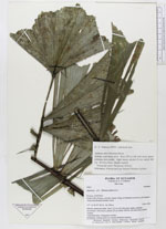
| Family | Arecaceae |
| Identification | Aiphanes ulei (Dammer)Burret |
| Determined by | |
| Identification qualifier | |
| Field notes | Solitary understory palm. Stem 155 cm tall with many spines pointing downwards. Eitht leaves, petiole 22 cm, rachis 108 cm. On terra firme. Sterile voucher. Vernacular name: Túntuamar (Achuar) Informants: Alfonso and Luis Antonio Mashient (achuar). |
| |
| Display all 62 georeferenced records of Aiphanes Aiphanes ulei |
| New Search Modify Search |