| Collector | Pedersen, H.B. |
| Number | 97611 |
| Collected with | Evans, D. |
| Country | Ecuador |
| Subpart | PASTAZA |
| County | |
| Locality | Near the Achuar village of Mashient, northside of Rio Pastaza. Terra firme. Primary forest. |
| Coordinates | 2° 8' S 77° 18' W |
| Minimum elevation (m) | 500 |
| Maximum elevation (m) | 500 |
| Start date | 1990/10/04 |
| End date | 1990/10/04 |
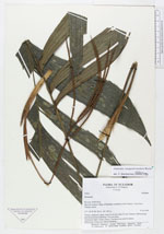
| Family | Arecaceae |
| Identification | Geonoma longepedunculata Burret |
| Determined by | Borchsenius, F. (AAU), 1996. |
| Identification qualifier | |
| Field notes | Solitary understory palm. Stem 50 cm tall, diam 2.5 cm. 8 leaves. Inflorescence and infructescence interfoliar. On terra firma. Vernacular name: Turuji (Ahuar). The leaves are used for thatch. INformants: Carlos and Alfredo Mashient. |
|
 Other records of Geonoma longepedunculata