| Collector | Pedersen, H. B. |
| Number | 104165 |
| Collected with | |
| Country | Ecuador |
| Subpart | LOJA |
| County | |
| Locality | Parque National Podocarpus/ Reserva El Bosque, above San Pedro de Vilcabamba (5 km east of the village). Trail from Loma El Trigal to Rio Banderilla. |
| Coordinates | 4° 16' S 79° 10' W |
| Minimum elevation (m) | 2150 |
| Maximum elevation (m) | 2150 |
| Start date | 1994/12/02 |
| End date | 1994/12/02 |
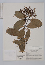
| Family | Myrtaceae |
| Identification | Calyptranthes concinna DC. |
| Determined by | M.L. Kawasaki & B.K. Holst |
| Identification qualifier | |
| Field notes | Tree, 6 m tall. |
|
 Other records of Calyptranthes concinna