AAU Herbarium Database |
| New Search Modify Search |
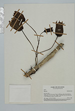
| Collector | Pedersen, H.B. |
| Number | 104131 |
| Collected with | |
| Country | Ecuador |
| Subpart | LOJA |
| County | |
| Locality | Parque National Podocarpus/ Reserva El Bosque, above San Pedro de Vilcabamba (5 km east of the village). Along trail from Rio Banderilla to Fila Banderilla, humid to semidry forest. |
| Coordinates | 4° 16' S 79° 10' W |
| Minimum elevation (m) | 2100 |
| Maximum elevation (m) | 2100 |
| Start date | 1994/11/30 |
| End date | 1994/11/30 |
| Family | Solanaceae |
| Identification | Trianaea |
| Determined by | Anders Orejuela (E) |
| Identification qualifier | |
| Field notes | |
| |
 Other records of Trianaea Other records of TrianaeaThe map displays only records from the Aarhus Herbarium Database. The records may not represent the full distribution of Trianaea |
| New Search Modify Search |