AAU Herbarium Database |
| New Search Modify Search |
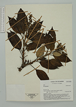
| Collector | Lewis, G.P. |
| Number | 3793 |
| Collected with | C.E.Hughes |
| Country | Ecuador |
| Subpart | Loja |
| County | |
| Locality | 1 km S of Yangana, track to Sierra Toledo, km 19.5.. Páramo. |
| Coordinates | 4° 23' S 79° 6' W |
| Minimum elevation (m) | 3325 |
| Maximum elevation (m) | 3325 |
| Start date | 1998/01/14 |
| End date | 1998/01/14 |
| Family | Araliaceae |
| Identification | Oreopanax Decne. & Planch. |
| Determined by | |
| Identification qualifier | |
| Field notes | Shrub, 2 mx 2.5 cm diam.; leaves coriaceous, very discolorous, dark bottle green, slightly glossy above, much paler with fawn-grey indumentum below; corolla very pale green, filaments white, anthers cream. In shrubby pockets on páramo. Sporadic. |
| |
| Display all 86 georeferenced records of Oreopanax Oreopanax |
| New Search Modify Search |