AAU Herbarium Database |
| New Search Modify Search |
| Collector | Lewis, G.P. |
| Number | 3434 |
| Collected with | B. Merino & N. Aguirre |
| Country | Ecuador |
| Subpart | Azuay |
| County | |
| Locality | 21 Km SE of Troncal, track from Zuchay to Manta Real, 2.5 to 3.5 km above Manta Real |
| Coordinates | 2° 34' S 79° 21' W |
| Minimum elevation (m) | 450 |
| Maximum elevation (m) | 450 |
| Start date | 1997/08/13 |
| End date | 1997/08/13 |
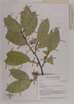
| Family | Bombacaceae |
| Identification | Quararibea |
| Determined by | Carvalho-Sobrinho, J.G. |
| Identification qualifier | |
| Field notes | Tree, 20 m x 25-30 cm, bark smooth, grey, lichen-mottled, wood cream, slash cream; leaves semi-coriaceous, lime green, buds and calyces with a pale brown indumentum; flowers with a slight sweet scent, petals reflexed, white, staminal tube white, stigma pale yellow."Wood cut to make planks for small trucks |
| |
 Other records of Quararibea Other records of QuararibeaThe map displays only records from the Aarhus Herbarium Database. The records may not represent the full distribution of Quararibea |
| New Search Modify Search |