AAU Herbarium Database |
| New Search Modify Search |
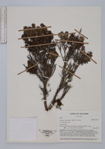
| Collector | Lewis, G.P. |
| Number | 3352 |
| Collected with | |
| Country | Ecuador |
| Subpart | Loja |
| County | |
| Locality | Parque Nacional de Podocarpus, Cajanuma, Mirador trail. 79°10'630''W;4°06'725''S. Vegetation: Low bosque nublado and ericaceous scrub on ridge top. |
| Coordinates | 4° 6' 45'' S 79° 10' 37.8'' W |
| Minimum elevation (m) | 3000 |
| Maximum elevation (m) | 3000 |
| Start date | 1997/06/18 |
| End date | 1997/06/18 |
| Family | Myrtaceae |
| Identification | Myrteola phylicoides (Benth.) Landrum |
| Determined by | M.L. Kawasaki |
| Identification qualifier | |
| Field notes | Shrub, 1,5-2m x 2 cm diam., contorted trunk, bark smooth pale orange-brown; leaves semi-coriaceous, yellowish lime-green glossy above, paler whitish green dull below; calyces green, petals white with a pale pinkish lilac base, filaments white, anthers creamish pale yellow. |
| |
 Other records of Myrteola phylicoides Other records of Myrteola phylicoidesThe map displays only records from the Aarhus Herbarium Database. The records may not represent the full distribution of Myrteola phylicoides |
| New Search Modify Search |