| Collector | Lewis, G.P. |
| Number | 3309 |
| Collected with | T.Delgado & H.Alejandro |
| Country | Ecuador |
| Subpart | Loja |
| County | |
| Locality | Catamayo-Catacocha, km 14, San Vicente, 3 km past junction to El Cisne and San Pedro de la Bendita. Vegetation: Bosque seco in small quebrada |
| Coordinates | 3° 57' 2'' S 79° 26' 57'' W |
| Minimum elevation (m) | 1875 |
| Maximum elevation (m) | 1875 |
| Start date | 1997/05/18 |
| End date | 1997/05/18 |
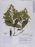
| Family | Asteraceae |
| Identification | Trixis sagasteguii Cabrera |
| Determined by | H. Robinson (US) |
| Identification qualifier | |
| Field notes | Semi-scandent shrub, 3 m x 2 cm, bark pale brown, leaflets mid-green; phyllaries lime-green, pappus straw-coloured, disc florets sunshine-yellow. Locally common on bosque margin |
|
 Other records of Trixis sagasteguii