AAU Herbarium Database |
| New Search Modify Search |
| Collector | Lewis, G.P. |
| Number | 2627 |
| Collected with | P.Lozano, N.Aguirre & I.Aldaz |
| Country | Ecuador |
| Subpart | Loja |
| County | |
| Locality | Saraguro-Manu, dirt road to Río Negro, km 4 from Bellavista. |
| Coordinates | 3° 31' S 79° 24' W |
| Minimum elevation (m) | 3060 |
| Maximum elevation (m) | 3060 |
| Start date | 1996/10/03 |
| End date | 1996/10/03 |
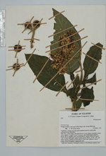
| Family | Solanaceae |
| Identification | Solanum oblongifolium Dunal |
| Determined by | Tiina Sarkinen |
| Identification qualifier | |
| Field notes | Vegetation: bosque húmedo and secondary scrub in small gulley surrounded by cultivation. Tree, 5 m x 20 diam., bark pale brown, crown dense, roundish, foliate, stem slightly winged; leaves undulate, dark bottle-green slightly glossy above, slightly paler and dull bellow, calyces yellowish green with swollen dark green glossy apices, petals fleshy, white with pale yellow apices, stamens golden-yellow, fruits hard, globose with a pulpy centre blue-green. Apparently rare. |
| |
 Other records of Solanum oblongifolium Other records of Solanum oblongifoliumThe map displays only records from the Aarhus Herbarium Database. The records may not represent the full distribution of Solanum oblongifolium |
| New Search Modify Search |