| Collector | Lewis, G.P. |
| Number | 2601 |
| Collected with | P.Lozano, N.Aguirre, I.Aldaz |
| Country | Ecuador |
| Subpart | Loja |
| County | |
| Locality | Route Saraguro-Manu, dirt road to Río Negro, 3 km from Bellavista, 6 km from Manu. Bosque húmedo, partly disturbed. |
| Coordinates | 3° 31' 38.94'' S 79° 24' 6.36'' W |
| Minimum elevation (m) | 2800 |
| Maximum elevation (m) | 2950 |
| Start date | 1996/10/02 |
| End date | 1996/10/02 |
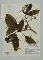
| Family | Araliaceae |
| Identification | Oreopanax Decne. & Planch. |
| Determined by | |
| Identification qualifier | |
| Field notes | Shrub to 1.5 m; bark greyish, crown dense, compact; leaves mid-green, slightly glossy above; calyces green, corollas creamish white; fruits subglobose, green. Locally common. As Lewis et al. 2600 but in more open areas of bosque and differing in having larger leaves and longer, reddish petioles. |
|