AAU Herbarium Database |
| New Search Modify Search |
| Collector | Lewis, G.P. |
| Number | 2459 |
| Collected with | |
| Country | Ecuador |
| Subpart | Loja |
| County | |
| Locality | Road Malacatos-Loja, c km 5. Vegetation: secondary roadside scrub and cultivated land |
| Coordinates | 4° 12' S 79° 12' W |
| Minimum elevation (m) | 1625 |
| Maximum elevation (m) | 1625 |
| Start date | 1996/07/23 |
| End date | 1996/07/23 |
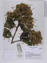
| Family | Asteraceae |
| Identification | Vernonanthura patens (Kunth)H.Rob. |
| Determined by | H. Robinson |
| Identification qualifier | |
| Field notes | Single or multiple-stemmed shrub, 3m x 4 cm diam., bark pale grey; leaves dark green dull above, slightly paler and dull below; flowers sweetly scented, phyllaries green, florets white. Locally common along the Malacatos to Loja road |
| |
| Display all 37 georeferenced records of Vernonanthura Vernonanthura patens |
| New Search Modify Search |