AAU Herbarium Database |
| New Search Modify Search |
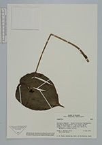
| Collector | Webster, G.L. |
| Number | 29233 |
| Collected with | Fred Hrusa |
| Country | Ecuador |
| Subpart | Pichincha |
| County | |
| Locality | Canton Quito, Parroquia Nanegal: Bosque Protectora Maquipucuna, Montañas de Maquipucuna, rainforest om main ridge of Cerro Sosa, c. 7 km airline SE of Nanegal |
| Coordinates | 0° 4' 5'' N 78° 36' 5'' W |
| Minimum elevation (m) | 1800 |
| Maximum elevation (m) | 1800 |
| Start date | 1992/07/08 |
| End date | 1992/07/08 |
| Family | Orchidaceae |
| Identification | Lepanthes |
| Determined by | |
| Identification qualifier | |
| Field notes | Epiphytic; flowers yellow |
| |
| Display all 147 georeferenced records of Lepanthes Lepanthes |
| New Search Modify Search |