AAU Herbarium Database |
| New Search Modify Search |
| Collector | Herrera , G. |
| Number | 9894 |
| Collected with | Jose Antonio G.B. Pinho |
| Country | Suriname |
| Subpart | Sipaliwini |
| County | |
| Locality | Vicinity of camp on W bank of Zuid River, across river from (i.e. W and outside of) Central Suriname Nature reserve, ca. 10 km straight line distance SSE of Kayserberg Airstrip |
| Coordinates | 3° 0' 3'' N 56° 27' 3'' W |
| Minimum elevation (m) | 240 |
| Maximum elevation (m) | 240 |
| Start date | 2003/06/13 |
| End date | 2003/06/13 |
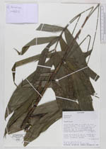
| Family | Arecaceae |
| Identification | Bactris |
| Determined by | |
| Identification qualifier | |
| Field notes | Areas de bosque primario. Palma de 3 tallos de 1.3 m de altura. riparia; frutos inmaduros verdes |
| |
| Display all 106 georeferenced records of Bactris Bactris |
| New Search Modify Search |