| Collector | Galeano, G. |
| Number | 8204 |
| Collected with | H. Balslev, I.L. Olivares, J. Carreño, J.C. Copete, D. Jiménez, S. Valenciá & L.A. Núñez |
| Country | Colombia |
| Subpart | Valle del Cauca |
| County | |
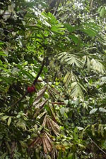
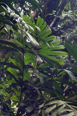
| Locality | 22 km NW of Buenaventura, 21 km NE of Bahía Málaga naval base. La Plata. Los Indios. Wet tropical rainforest on hills behind mangrove. |
| Coordinates | 4° 3' 49.23'' N 77° 9' 53.362'' W |
| Minimum elevation (m) | 9 |
| Maximum elevation (m) | 80 |
| Start date | 2011/08/21 |
| End date | 2011/08/21 |
| Family | Arecaceae |
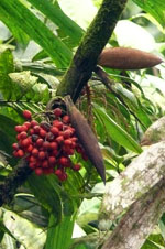
| Identification | Bactris hondurensis Standl. |
| Determined by | G.Galeano (COL) & H.Balslev (AAU) |
| Identification qualifier | cf. |
| Field notes | Cespitose midstory palm. Stems 2-10 m high, 3 cm thick. Leaves 6 per stem; sheath 27 cm long, open; petiole 44 cm long; rachis 87 cm long; lamina pinnate; pinnae 12 per side; basal pinna 52 cm long, 2 cm wide, middle pinna 55 cm long, 3.5 cm wide, apical pinna 42 cm long, 14 cm wide. Transect: HB 1051 |
|
 Other records of Bactris hondurensis