| Collector | Galeano, G. |
| Number | 8201 |
| Collected with | H. Balslev, I.L. Olivares, J. Carreño, J.C. Copete, D. Jiménez, S. Valenciá & L.A. Núñez |
| Country | Colombia |
| Subpart | Valle del Cauca |
| County | |
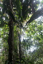
| Locality | 22 km NW of Buenaventura, 21 km NE of Bahía Málaga naval base. La Plata. Los Indios. Wet tropical rainforest on hills behind mangrove. |
| Coordinates | 4° 3' 49.23'' N 77° 9' 53.362'' W |
| Minimum elevation (m) | 9 |
| Maximum elevation (m) | 80 |
| Start date | 2011/08/21 |
| End date | 2011/08/21 |
| Family | Arecaceae |
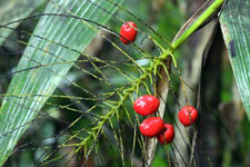
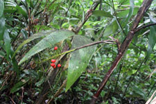
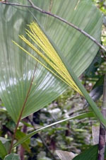
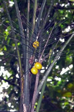
| Identification | Synechanthus warscewiczianus H.Wendl. |
| Determined by | G.Galeano (COL) & H.Balslev (AAU) |
| Identification qualifier | |
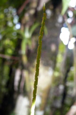
| Field notes | Solitary palm. Stem 1.8 m high, 2 cm thick. Leaves 7; sheath 40 cm long; petiole 29 cm long; rachis 49 cm long; lamina entire or pinnate 79 cm long, 22 cm wide, flat. Infructescence infrafoliar; peduncle 40 cm long; rachis 11 cm long; rachillae 35 cm, 6-17 cm long. Fruits yellow, 2.5 cm long, 2 cm wide. Transect: HB 1051 |
|