| Collector | Galeano, G. |
| Number | 8183 |
| Collected with | H. Balslev, I.L. Olivares, J. Carreño, J.C. Copete, D. Jiménez, S. Valenciá & L.A. Núñez |
| Country | Colombia |
| Subpart | Valle del Cauca |
| County | |
| Locality | 33 km NW of Buenaventura, 18 km NNE of Bahía Málaga naval base. La Plata. Quebrada Alegría. Wet tropical rainforest on hills behind mangrove. |
| Coordinates | 4° 7' 2.962'' N 77° 15' 12.519'' W |
| Minimum elevation (m) | 14 |
| Maximum elevation (m) | 14 |
| Start date | 2011/08/19 |
| End date | 2011/08/19 |
| Family | Arecaceae |
| Identification | Geonoma paradoxa Burret |
| Determined by | G.Galeano (COL) & H.Balslev (AAU) |
| Identification qualifier | |
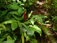
| Field notes | Solitary understory palm. Acaulecent. Leaves 10; petiole 32 cm long, covered by a light brown indumentum, section margined; rachis 34 cm long; lamina pinnate; pinnae 3 per side; basal pinna 23 cm long, 5 cm wide, middle pinna 20 cm long, 8 cm wide, apical pinna 22 cm long, 19 cm wide. Infructescence interfoliar; prophyll 5 cm long; peduncle 69 cm long; spike 11 cm long. Silica gel sample taken. Transect: HB 1048, subunit no. 85 |
|
 Other records of Geonoma paradoxa