AAU Herbarium Database |
| New Search Modify Search |
| Collector | Galeano, G. |
| Number | 8158 |
| Collected with | H. Balslev, I.L. Olivares, J. Carreño, J.C. Copete, D. Jiménez, S. Valenciá & L.A. Núñez |
| Country | Colombia |
| Subpart | Valle del Cauca |
| County | |
| Locality | 24 km NW of Buenaventura, 18 km ENE of Bahía Málaga naval base. La Plata. Sitio El Divorcio. Wet tropical rainforest on hills behind mangrove. |
| Coordinates | 4° 3' 41.136'' N 77° 11' 37.798'' W |
| Minimum elevation (m) | 17 |
| Maximum elevation (m) | 17 |
| Start date | 2011/08/17 |
| End date | 2011/08/17 |
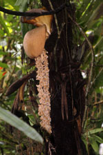
| Family | Arecaceae |
| Identification | Wettinia aequalis (Cook & Doyle)R. Bernal |
| Determined by | G.Galeano (COL) & H.Balslev (AAU) |
| Identification qualifier | |
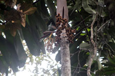
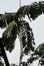
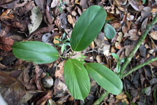
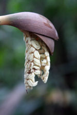
| Field notes | Solitary palm. Stem 8 m high; internodes 2 cm long, < stem diameter, green. Crownshaft present. Leaves 6; sheath 80 cm long, closed; petiole 20 cm long, section round; rachis 3 m long; lamina pinnate; pinnae 37 per side, regularly inserted in groups of 2; basal pinna 55 cm long, middle pinna 71 cm long, apical pinna 41 cm long. Inflorescence/infructescence infrafoliar, multiple; prophyll 2 cm long, 1 cm wide, woody; peduncular bract 10 cm long, inserted 4 cm from base, brown, herbaceous; peduncle 10 cm long, 3 cm wide; rachis 5 cm long, 2 cm wide; rachillae 6, 15-20 cm long. Flowers sessile, cream. Fruits green, 2.5x2.5 cm. Silica gel sample taken. Transect: HB 1046 |
| |
 Other records of Wettinia aequalis Other records of Wettinia aequalisThe map displays only records from the Aarhus Herbarium Database. The records may not represent the full distribution of Wettinia aequalis |
| New Search Modify Search |