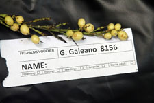
| Collector | Galeano, G. |
| Number | 8156 |
| Collected with | H. Balslev, I.L. Olivares, J. Carreño, J.C. Copete, D. Jiménez, S. Valenciá & L.A. Núñez |
| Country | Colombia |
| Subpart | Valle del Cauca |
| County | |
| Locality | 24 km NW of Buenaventura, 18 km ENE of Bahía Málaga naval base. La Plata. Sitio El Divorcio. Wet tropical rainforest on hills behind mangrove. |
| Coordinates | 4° 3' 41.136'' N 77° 11' 37.798'' W |
| Minimum elevation (m) | 17 |
| Maximum elevation (m) | 17 |
| Start date | 2011/08/17 |
| End date | 2011/08/17 |
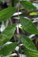
| Family | Arecaceae |
| Identification | Desmoncus cirrhifera Gentry & Zardini |
| Determined by | G.Galeano (COL) & H.Balslev (AAU) |
| Identification qualifier | |
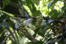
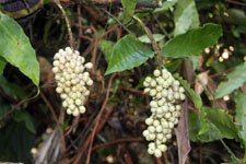
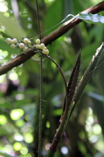
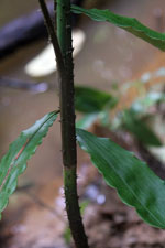
| Field notes | Liana. Stem 1 cm thick; internodes 29 cm long, green, smooth. Leaf sheath 21 cm long; petiole 79 cm long; rachis 104 cm long; lamina pinnate; pinnae 10 per side, insertion irregular; basal pinna 14 cm long, 5 cm wide, middle pinna 15 cm long, 5.5 cm wide, apical pinna 9 cm long, 3 cm wide. Infructescence interfoliar; prophyll 46 cm long; peduncular bract brown; peduncle 60 cm long; rachis 14 cm long; rachillae 21, 1-3 cm long. Fruits light green, 1 cm long, 0.5 cm wide. Silica gel sample taken. Transect: HB 1046 |
|
 Other records of Desmoncus cirrhifera