AAU Herbarium Database |
| New Search Modify Search |
| Collector | Davidse, G. |
| Number | 25786 |
| Collected with | G.Herrera, R.H.Warner |
| Country | Costa Rica |
| Subpart | Limon |
| County | |
| Locality | Cordillera de Talamanca, head- waters of the unnamed western branch of the Río Teribe, between the Río Sini and the continental divide at Cerro Bekom. Mixed oak forest along river with a clearing of kikuyu pasture. |
| Coordinates | 9° 10' 45'' N 83° 3' 30'' W |
| Minimum elevation (m) | 2500 |
| Maximum elevation (m) | 2600 |
| Start date | 1984/03/21 |
| End date | 1984/03/27 |
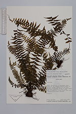
| Family | Aspleniaceae |
| Identification | Asplenium harpeodes Kze. |
| Determined by | H.v.d.Werff |
| Identification qualifier | |
| Field notes | Epiphyte. |
| |
| Display all 33 georeferenced records of Asplenium Asplenium harpeodes |
| New Search Modify Search |