AAU Herbarium Database |
| New Search Modify Search |
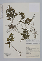
| Collector | Davidse, G. |
| Number | 18205 |
| Collected with | Á.C.González, R.A.León |
| Country | Venezuela |
| Subpart | Zulia |
| County | |
| Locality | Distrito Perijá: 2 km W of the intersection of the Río Aricuaisá and the Maracaibo-La Fria Hwy. (Hwy. 6). Tall, evergreen forest on hummocky soil subject to inundation. |
| Coordinates | 9° 25' N 72° 37' W |
| Minimum elevation (m) | 10 |
| Maximum elevation (m) | 10 |
| Start date | 1980/06/19 |
| End date | 1980/06/19 |
| Family | Aspleniaceae |
| Identification | Asplenium ortegae Murakami & Moran |
| Determined by | H.v.d.Werff |
| Identification qualifier | |
| Field notes | Terrestrial fern. |
| |
 Other records of Asplenium ortegae Other records of Asplenium ortegaeThe map displays only records from the Aarhus Herbarium Database. The records may not represent the full distribution of Asplenium ortegae |
| New Search Modify Search |