AAU Herbarium Database |
| New Search Modify Search |
| Collector | Skov, F. |
| Number | 64755 |
| Collected with | Borchsenius, F. |
| Country | Ecuador |
| Subpart | NAPO |
| County | |
| Locality | Road from Baeza to Tena, km 6. Patches of secondary forest on pasture. |
| Coordinates | 0° 30' S 77° 51' W |
| Minimum elevation (m) | 2000 |
| Maximum elevation (m) | 2000 |
| Start date | 1987/10/21 |
| End date | 1987/10/21 |
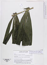
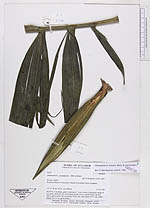
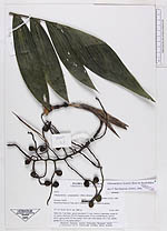
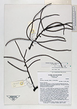
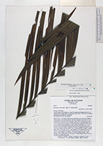
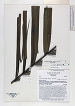
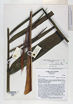
| Family | Arecaceae |
| Identification | Chamaedorea linearis (Ruiz & Pav.)Mart. |
| Determined by | Borchsenius, F. (AAU), 1996. |
| Identification qualifier | |
| Field notes | Stem 4 m, 5 cm diam., green; internodes 4 -5 cm. Leaves 4, spreading; sheath 30 cm, green, closed for 2/3 of its length; petiole 14 cm, rounded below, groovd above, green; rachis 105 cm; pinnae 18 per side, basal pinnae 30 x 7 cm, middle pinnae 38 x 11 cm, apical pinnae ? |
| |
| Display all 110 georeferenced records of Chamaedorea Chamaedorea linearis |
| New Search Modify Search |