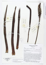
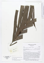
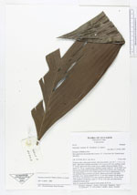
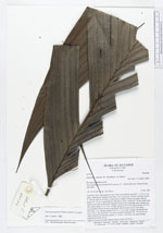
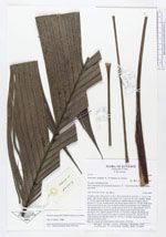
| Field notes | Cespitose often with suckers at base. Stem procumbent, erect for 1 - 1.5 m, 3 cm diam., light brown, shining, internodes 3 cm. Leaves to 10, erect, arching; sheath 9 - 20 cm, open to the base in older leaves, slightly fibrous at margin, brown; petiole 25 - 45 cm, rounded below, flat above, green; rachis 50 - 54 cm; blade from almost undivided an then split randomly along veins to pinnate with 3 pinnae per side, basal pinnae 31 X 12 cm, middle pinnae 44 X 10 cm, apical pinnae 31 X 12 cm, all pinnae long acuminate and falcate. Inflorescences up to 3 per plant, interfoliar, erect, spicate; prophyll 28 cm, 2.5 cm wide, winged, red; peduncular bract 32 cm, red, inserted 0.5 cm above prophyll; peduncle 28 - 70 cm, 0.8 cm wide, flattened, red apically; rachis 12 - 25 cm, 1 cm wide, red; fruits densely clustered on rachis, green. Note: G. cuneata are often found in dense stands, 10 X 5 m. |