AAU Herbarium Database |
| New Search Modify Search |
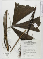
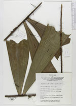
| Collector | Kahn, F. |
| Number | 2321 |
| Collected with | |
| Country | Peru |
| Subpart | |
| County | |
| Locality | Lower Ucayali River Basin, Jenaro Herrera. Km 15 of the road. Wet forest, near “Copal” stream |
| Coordinates | 4° 55' S 73° 40' W |
| Minimum elevation (m) | 0 |
| Maximum elevation (m) | 0 |
| Start date | 1988/08/22 |
| End date | 1988/08/22 |
| Family | Arecaceae |
| Identification | Aiphanes ulei (Dammer)Burret |
| Determined by | |
| Identification qualifier | |
| Field notes | Acaulescent.Leaf: petiole 0.15 m long. 12 pairs of pinnae (groups of 2). Spines, flattened, black, up to 5 cm long, on petiole, rachis and blade. Inflorescence: peduncle 70 cm long, rachis 40 cm long. Prophyll: about 15 cm long, sterile bract 90 cm long |
| |
| Display all 62 georeferenced records of Aiphanes Aiphanes ulei |
| New Search Modify Search |