AAU Herbarium Database |
| New Search Modify Search |
| Collector | Grijalva, E. |
| Number | 124 |
| Collected with | |
| Country | Ecuador |
| Subpart | Pichincha |
| County | |
| Locality | reserva Florística - Ecológica “Rio Guajalito”, km 59 de la carretera antigua Quito - Sto. Domingo de los Colorados, a 3 1/2 km al NE de la carretera, estribaciones occidentales del Volcan Pichincha |
| Coordinates | 0° 13' 53'' S 78° 48' '' W |
| Minimum elevation (m) | 2200 |
| Maximum elevation (m) | 2200 |
| Start date | 1987/02/11 |
| End date | 1987/02/11 |
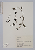
| Family | Rubiaceae |
| Identification | Manettia |
| Determined by | |
| Identification qualifier | |
| Field notes | Bejuco trepador con cáliz verde |
| |
 Other records of Manettia Other records of ManettiaThe map displays only records from the Aarhus Herbarium Database. The records may not represent the full distribution of Manettia |
| New Search Modify Search |