AAU Herbarium Database |
| New Search Modify Search |
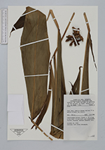
| Collector | de Vogel, E.F. |
| Number | 7753 |
| Collected with | V.Balgooy, Widjaja |
| Country | Indonesia |
| Subpart | Java |
| County | |
| Locality | West Java, road to Gunung Halimun 15 km before Nirmala Tea State. Undisturbed primary forest c. 25 m high along small stream with much undergrowth terrain sloping, bedrock volcanic rock. |
| Coordinates | |
| Minimum elevation (m) | 950 |
| Maximum elevation (m) | 950 |
| Start date | 1985/10/03 |
| End date | 1985/10/03 |
| Family | Zingiberaceae |
| Identification | Amomum |
| Determined by | |
| Identification qualifier | |
| Field notes | Solitary herb along streamlet. Alcohol n. 9238 |
| |
| This record has no coordinates. Display map with the 79 georeferenced records of Amomum in the AAU Herbarium Database. |
| New Search Modify Search |