| Collector | Neill, D. |
| Number | 9086 |
| Collected with | W. Palacios |
| Country | Ecuador |
| Subpart | Napo |
| County | |
| Locality | Cantón Archidona. South slopes of Volcán Sumaco. 5 km east of Huamaní. Ridge above west side of valley of Río Pucuno; new road to Galeras under construction. Premontane Rain Forest; volcanic soils. |
| Coordinates | 0° 44' S 77° 35' W |
| Minimum elevation (m) | 1100 |
| Maximum elevation (m) | 1100 |
| Start date | 1989/10/19 |
| End date | 1989/10/19 |
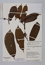
| Family | Annonaceae |
| Identification | Annona dolichopetala (R.E.Fr.) H.Rainer |
| Determined by | Dr. Paul Maas |
| Identification qualifier | |
| Field notes | Tree 15 m tal; subcanopy of primary forest. Leaves whitish beneath. |
|
 Other records of Annona dolichopetala