AAU Herbarium Database |
| New Search Modify Search |
| Collector | Neill, D. |
| Number | 8568 |
| Collected with | F.Hurtado, A. Alvarado |
| Country | Ecuador |
| Subpart | Napo |
| County | |
| Locality | Carretera Hollín-Loreto, 5 km al W de Guamaní, faldas del Volcán Sumaco. Bosque muy húmedo Premontano. Bosque primario y secundario. |
| Coordinates | 0° 43' S 77° 38' W |
| Minimum elevation (m) | 1200 |
| Maximum elevation (m) | 1200 |
| Start date | 1988/09/06 |
| End date | 1988/09/07 |
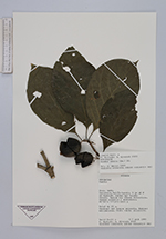
| Family | Rubiaceae |
| Identification | Randia armata (Sw.)DC. |
| Determined by | |
| Identification qualifier | |
| Field notes | Árbol de 15 m. Subdosel del bosque primario. Espinas estipulares. Fruto verde, elipsoide. |
| |
 Other records of Randia armata Other records of Randia armataThe map displays only records from the Aarhus Herbarium Database. The records may not represent the full distribution of Randia armata |
| New Search Modify Search |