| Collector | Neill, D. |
| Number | 16231 |
| Collected with | W. Quizhpe |
| Country | Ecuador |
| Subpart | Zamora-Chinchipe |
| County | |
| Locality | Centinela del Cóndor. Cordillera del Cóndor, western slopes. Río Blanco watershed, tributary of Río Machinaza. Montane wetcloud forest on ridgetop, with abundant epiphytes, one km S of Paquisha Alto military post. Forest inventory plot, 0.25-hectare. "Emperador" concession of Aurelian gold mine company. |
| Coordinates | 3° 55' 6'' S 78° 29' 34'' W |
| Minimum elevation (m) | 1960 |
| Maximum elevation (m) | 1960 |
| Start date | 2008/03/17 |
| End date | 2008/03/17 |
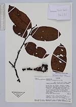
| Family | Annonaceae |
| Identification | Guatteria punctata (Aubl.)Howard |
| Determined by | Name updated acc. to Tropicos |
| Identification qualifier | |
| Field notes | Tree 25 m tall, with trunk 30 cm diameter. Tree located just outside of Emperador tree plot, not tagged. Fruiting monocarps pale green. |
|