| Collector | Neill, D. |
| Number | 15125 |
| Collected with | T.Croat, W.Quizhpe |
| Country | Ecuador |
| Subpart | Zamora-Chinchipe |
| County | |
| Locality | El Pangui. Cordillera del Cóndor, western slopes. Upper Río wawaime watershed; tributary of Río Quimi. Ridge above proposed EcuaCorriente copper mine site. Below sandstone plateau; fragments of sandstone eroded from above as soil source. Dwarf, dense forest with canopy mostly 5-15 m tall. |
| Coordinates | 3° 34' 44'' S 78° 26' 7'' W |
| Minimum elevation (m) | 1320 |
| Maximum elevation (m) | 1320 |
| Start date | 2006/04/04 |
| End date | 2006/04/04 |
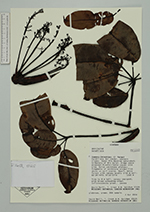
| Family | Araliaceae |
| Identification | Sciodaphyllum patulum Rusby |
| Determined by | Dr. Pete Lowry |
| Identification qualifier | |
| Field notes | Tree to 8 m tall; canopy emergent, with broad spreading crown. Inflorescences green. Leaves glabrous, green. DNA sample. |
|
 Other records of Sciodaphyllum patulum