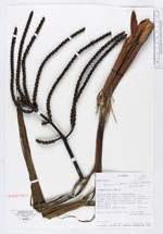
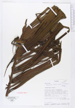
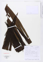
| Collector | Neill, D. |
| Number | 13518 |
| Collected with | L.Jost, J.Caranqui & E.Toapanta |
| Country | Ecuador |
| Subpart | |
| County | |
| Locality | Parque Nacional Llanganates. Cordillera Sacha Llanganates. Summit ridge, overlooking Amazon lowlands to east, Rio Zuñac watershed to west. Very dense, wet cloud forest. Granite substrate |
| Coordinates | 1° 21' 50'' S 78° 7' 32'' W |
| Minimum elevation (m) | 2740 |
| Maximum elevation (m) | 2740 |
| Start date | 2001/10/30 |
| End date | 2001/10/30 |
| Family | Arecaceae |
| Identification | Geonoma densa Linden & H. Wendl. |
| Determined by | Balslev,H. |
| Identification qualifier | |
| Field notes | Common palm to 8 m tall, 10 cm DBH |
|
 Other records of Geonoma densa