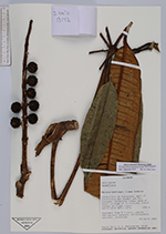
| Collector | Neill, D. |
| Number | 13142 |
| Collected with | J. Manzanares |
| Country | Ecuador |
| Subpart | Morona-Santiago |
| County | |
| Locality | Cordillera de Huaracayo, east of Cordillera del Cóndor and Río Coangos. Sandstone ridge, east of Shuar village of Tinkimints. Cloud forest on ridge crest |
| Coordinates | 3° 15' 18'' S 78° 11' 10'' W |
| Minimum elevation (m) | 1750 |
| Maximum elevation (m) | 1750 |
| Start date | 2001/03/23 |
| End date | 2001/03/23 |
| Family | Araliaceae |
| Identification | Sciodaphyllum panguiense in ed. |
| Determined by | Dr. Pete Lowry |
| Identification qualifier | |
| Field notes | Scandent tree 8 m tall. Leaves ferruginous beneath. Inflorescence terminal, branched |
|