AAU Herbarium Database |
| New Search Modify Search |
| Collector | Neill, D. |
| Number | 10858 |
| Collected with | |
| Country | Ecuador |
| Subpart | Pastaza |
| County | |
| Locality | Cantón Pastaza. Río Villano, 1 km east of Huito-Bellavista. Alluvial terrace, floodplain. 2 km south of porposed ARCO oil pipeline. Tropical mois forest |
| Coordinates | 1° 29' S 77° 32' W |
| Minimum elevation (m) | 390 |
| Maximum elevation (m) | 600 |
| Start date | 1997/02/09 |
| End date | 1997/02/09 |
| Family | Arecaceae |
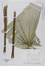
| Identification | Chelyocarpus ulei Dammer |
| Determined by | H. Balslev |
| Identification qualifier | |
| Field notes | |
| |
| Display all 33 georeferenced records of Chelyocarpus Chelyocarpus ulei |
| New Search Modify Search |