AAU Herbarium Database |
| New Search Modify Search |
| Collector | Smith, D.N. |
| Number | 9139 |
| Collected with | L.Sánchez, H.Vidaurre |
| Country | Peru |
| Subpart | Ancash |
| County | |
| Locality | Yungai. Huascarán National Park, Quebrada Ranincuray. |
| Coordinates | 8° 59' S 77° 34' W |
| Minimum elevation (m) | 4000 |
| Maximum elevation (m) | 4300 |
| Start date | 1985/01/12 |
| End date | 1985/01/12 |
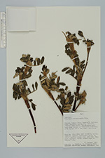
| Family | Rosaceae |
| Identification | Polylepis weberbaueri Pilger |
| Determined by | T.E. Boza E. |
| Identification qualifier | |
| Field notes | Shrubland/grassland with lenses of Polylepis weberbaueri forest and a few small moraines. Tree 8 m., 35 cm. DBH; bark reddish, multilayered, papery; pubescence buffy on twigs, whitish under lvs; sterile. "Queñual, quengua". Talus slopes edge of largest lake. |
| |
| Display all 43 georeferenced records of Polylepis Polylepis weberbaueri |
| New Search Modify Search |