AAU Herbarium Database |
| New Search Modify Search |
| Collector | Smith, D.N. |
| Number | 12055 |
| Collected with | R.Valencia, M.Buddeensiek |
| Country | Peru |
| Subpart | Ancash |
| County | |
| Locality | Huaylas. Huascarán National Park, lower slopes of Cerro Pakla. |
| Coordinates | 8° 49' S 77° 57' W |
| Minimum elevation (m) | 4100 |
| Maximum elevation (m) | 4300 |
| Start date | 1986/04/09 |
| End date | 1986/04/09 |
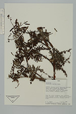
| Family | Rosaceae |
| Identification | Polylepis sericea Wedd. |
| Determined by | T.E. Boza E. |
| Identification qualifier | |
| Field notes | Puna grassland; steep to moderately steep slopes, southern aspects. Tree 3 m.; trunk twisted; bark multilayered, shreddy, oxide; pubescence silvery; inflorescence pendant; flowers reddish green. |
| |
| Display all 56 georeferenced records of Polylepis Polylepis sericea |
| New Search Modify Search |